
January to February
65°F-75°F • Peak Conditions
Prime Hiking Season
Cool mornings and mild afternoons make this the best stretch for foothill climbs, longer desert loops, and scenic river outings.
Yuma’s local hiking guide
Built for locals and visitors who want a trustworthy starting point for Yuma’s climbs, desert loops, and riverfront outings that bring you peace and clarity.
About Yuma Hiking & Trails
Yuma Hiking & Trails is an independent local guide for hikers looking for Yuma’s best desert loops, historic riverfront walks, and foothill climbs. From the Colorado River and birding wetlands to the Gila Mountains, Telegraph Pass, and wildlife country like Kofa National Wildlife Refuge and Imperial NWR, we focus on clear route details, elevation, and seasonal notes so you can pick the right outing with confidence.
Desert hiking here means serious sun and low humidity, so we also cover heat planning, hydration, and the best seasons for getting out, including Yuma’s strong winter hiking window. Whether you live in town or you are visiting for the first time, this site is built to help you explore Southwest Arizona safely and get more out of every trail.
Discover Yuma Outdoors
Sunniest City on Earth Yuma holds the official Guinness World Record as the sunniest place on the planet, receiving over 4,000 hours of sunlight every year. Situated in southwestern Arizona at the intersection of the Sonoran Desert, the Colorado River corridor, and the Gila River basin, Yuma offers an extraordinary blend of rugged mountain terrain, peaceful riparian oases, and vast open desert horizons.
Unlike higher elevation Arizona hiking hubs like Flagstaff or Sedona, Yuma sits near sea level (elevation ~141 ft), creating mild, warm winter conditions while surrounding mountain ranges such as the Gila Mountains, Kofa Mountains, and Laguna Mountains provide dramatic elevation gain, rocky ridgelines, and 360 degree desert vistas.
Best by season and terrain
Fall and Winter is the sweet spot for Yuma hiking. Late October through April brings cool mornings and mild afternoons that open up the full range of terrain foothill climbs, ridgeline walks, longer desert loops, and exposed canyon routes that would be punishing in summer. This is when Yuma rewards the most range and ambition.
Summer demands a different strategy. Heat sets in fast once the sun rises, so the best outings focus on predawn starts along shaded riverfront paths and wildlife refuge routes where conditions stay manageable longest. For those looking for An Easy Day in any season, flat river walks, park loops, and wetland routes deliver strong desert scenery without heavy climbing. When you’re ready to push harder, The Foothills and East Side Ridges offer the best elevation gain and view payoff Yuma has to offer.
Trail Guide and Essentials
Start Right
Yuma's desert heat can be intense, especially midday. Sunrise and late afternoon are the most comfortable windows for most local trails.
Stay Fueled
Carry at least 1-2 liters per person on short hikes, and more for exposed desert terrain. Electrolytes are essential during hot days.
Block the Sun
Wide brim hat, high SPF sunscreen, lightweight dryfit long sleeves, and UV safe sunglasses protect against strong desert glare.
Go Your Speed
Choose low elevation river walks for easy starts, then work into desert ridge and canyon terrain as your comfort level grows.
Dress for It
Sturdy shoes or boots with good grip handle loose rock and desert sand. A thin layer handles cool desert mornings and windy ridgelines.
Know Where You Are
Cell service can drop in remote washes; download maps offline beforehand and carry a small first aid kit on every outing.
Sonoran Desert Biodiversity
Desert Flora and Spring Blooms Hiking around Yuma immerses you in the iconic flora of the Sonoran Desert. Trails feature stately Saguaro cacti, spindly Ocotillo with flaming red spring blossoms, yellow flowering Palo Verde trees, fragrant Creosote bushes, and ancient Desert Ironwood trees. Following rare winter rains, spring (March April) brings vibrant desert wildflower displays across foothill washes and desert alluvial fans.
Wildlife Encounters Yuma’s desert and river ecosystems support rich biodiversity. Hikers frequently spot Desert Bighorn Sheep clinging to steep volcanic crags in Kofa National Wildlife Refuge, Gambel’s quail darting through mesquite thickets, roadrunners, red tailed hawks, and coyotes. Along the Colorado River wetlands, over 350 species of birds can be observed, making Yuma a world class destination for birdwatching hikers.
Geology and Viewpoints The geological features of the Yuma region are sculpted by volcanic activity and millions of years of erosion. From the jagged volcanic needles of Palm Canyon to the alluvial gravel washes of Fortuna Wash and the wind sculpted golden ridges of the Imperial Sand Dunes, Yuma provides unmatched scenery for sunrise climbs and sunset photography.
Best times by month
Cool mornings and mild afternoons make this the best stretch for foothill climbs, longer desert loops, and scenic river outings.
Wildflowers can show up in the warm season, and the desert feels open and inviting without the full intensity of summer heat.
Trail conditions heat up quickly. The smartest approach is sunrise hiking, shorter loops, and staying near the river or shaded routes.
High desert conditions demand caution. Focus on dawn outings, flat terrain, and one of Yuma’s cooler riverfront walks.
Heat begins to ease, and the foothills become very appealing again. This is a strong time for scenic valley views and moderate climbs.
Cooler weather and clear skies make this a standout period for nearly every trail style in Yuma, from easy walks to tough ridge hikes.
Find Your Pace
Easy Hikes for Beginners and Families If you are new to desert hiking or traveling with young children, Yuma has exceptional flat, paved, and shaded routes. The Colorado River State Historic Park Trail, West Wetlands Park loop, and Betty’s Kitchen Nature Trail deliver lush river scenery, gentle footing, and zero elevation gain.
Moderate Hikes for Day Hikers Looking for moderate distance and steady incline? Trails like Laguna Mountain Ridge, Sugarloaf Peak Loop, and Senators Wash offer rolling desert hills, gravel wash navigation, and rewarding views of desert reservoirs without extreme technical climbing.
Challenging Hikes for Experienced Climbers Seasoned hikers seeking elevation gain and rugged scrambles will thrive on Telegraph Pass, Fortuna Peak, and Signal Peak in Kofa NWR. These routes test your endurance on steep scree slopes, rocky ridgelines, and unmaintained desert trails.
Local favorites
Best for relaxed walks, easy outings, wildlife viewing, and lower heat conditions.
Best for sunrise climbs, ridge views, and more textured desert terrain close to town.
Best for remote open country hiking and a classic Yuma desert feel, plus popular corridors for offroading, ATVs, and other vehicles where access allows.
Best for easy birding walks by the water and Yuma’s signature foothill climb when you want a bigger challenge.
Responsible Hiking
Protecting Yuma’s fragile Sonoran Desert environment and staying safe requires following essential wilderness principles.
Leave No Trace Pack out all trash, food scraps, and organic waste. Desert dry air slows decomposition significantly.
Marked Trails Don’t mess up marked trails. Leave signs, cairns, and trail markers alone so the next person can still find their way.
Wildlife Safety and Distance Give desert bighorn sheep, rattlesnakes, and coyotes ample space. Never feed or approach wild desert animals.
Tell Someone Your Plan Always notify a family member or friend of your planned trail, start time, and expected return time before heading out.
Got Questions?
Yes! Yuma offers extraordinary desert hiking opportunities ranging from peaceful Colorado River wetlands to dramatic climbs in the Gila and Kofa Mountains. With over 300 sunny days per year and mild winter temperatures, Yuma is one of the Southwest’s best winter hiking destinations.
The ideal hiking season in Yuma runs from late October through April when daily temperatures average between 65°F and 80°F. Mid winter (November through February) offers crisp mornings and clear desert skies perfect for long day hikes.
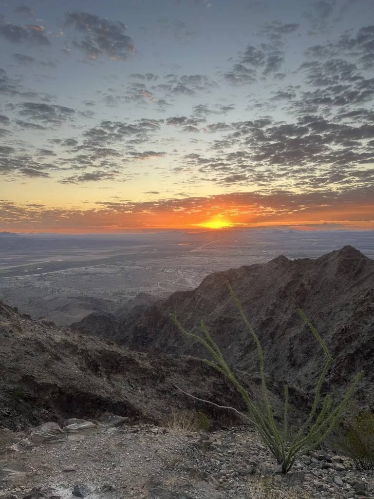
Telegraph Pass Trail in the Gila Mountains is Yuma’s most iconic and popular hike. It offers a steep, rewarding climb to a mountain summit with sweeping panoramic views of the Yuma Valley and surrounding desert terrain.
Summer temperatures in Yuma regularly exceed 105°F to 115°F. Hiking during peak summer heat is dangerous. If hiking between May and September, stick to predawn or sunrise starts on short, flat riverfront routes like West Wetlands, and finish before 8:00 AM with ample water.
Yes! Beginners and families love the Colorado River State Historic Park trail, West Wetlands Park loop, and Betty’s Kitchen Nature Trail. These offer flat terrain, shaded resting areas, and scenic water views without elevation gain.
Palm Canyon in the Kofa National Wildlife Refuge features Arizona’s only native California fan palms tucked inside a dramatic rock gorge. Imperial National Wildlife Refuge and Mittry Lake are ideal spots for birding and waterfowl observation.
Carry at least 1 liter of water per person per hour of hiking in moderate conditions, and up to 1 gallon per day on exposed desert routes. Always carry electrolyte supplements and turn around when half your water is gone.
Cell service is unreliable in remote desert canyons and wilderness areas like Kofa or Fortuna Wash. Always download offline topographical maps prior to your hike, carry a physical compass/map, tell someone your itinerary, and consider carrying a satellite GPS communicator.
Ready to start?